 |
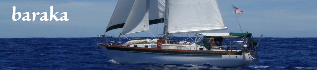
Baraka - Vancouver Island
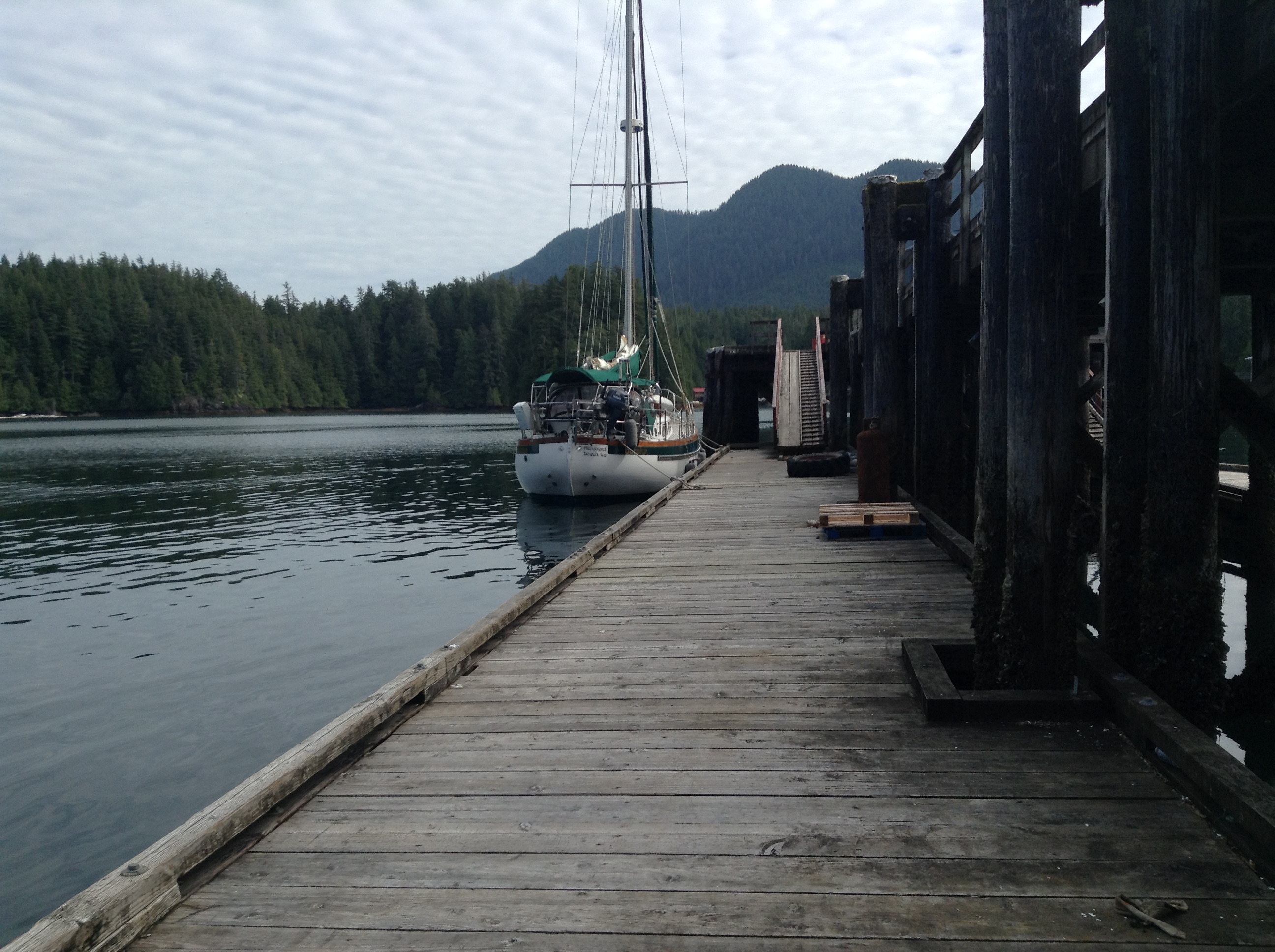
We are working our way home after a second summer in SE Alaska. After enjoying Haida Gwaii (aka the Queen Charlottes) the last part of July, we worked south to Port McNeill to prepare for our final leg, down the remote and rugged west side of Vancouver Island.
July 27 - Underway across Hecate/Queen Charlotte Straits
Easy day so far, making decent time under sail, motor off! We are once again a sailboat, first time this year. Dave had to remind me about the "finger puppet" when we set the shaft brake. We use the brake to prevent the shaft from turning the transmission without oil, which would burn it up. I made a small glove that fits over the shift lever as a reminder that we need to pulse the engine in reverse to release the brake when we motor again.
Haida Gwaii is now an indistinct smudge on the horizon. Glad we went there. It is a special place, and a piece of rapidly vanishing architectural history, though the proud Haida are actively working to keep their culture alive. As much as we've travelled, there are still amazing places awaiting our discovery.
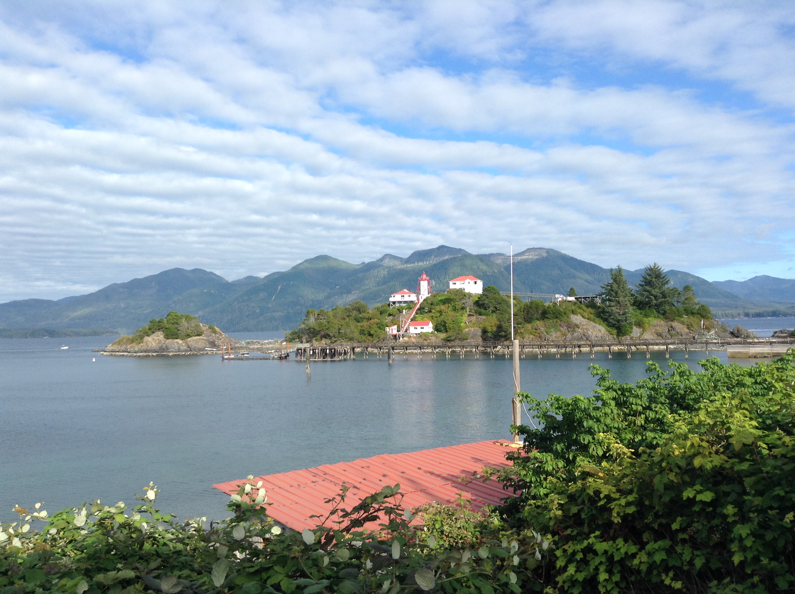
July 28 - Green Island Anchorage off Fitz Hugh Sound
Winds light overnight, so we motored with the main up. Only a handfull of fishing boats. Hit one log, no apparent damage. We closed on Calvert Island at dawn. I'd heard a radio announcement of a gale coming, so we bagged our planned anchorage at Adams Cove and continued on down the Calvert channels. There is a north channel and an east channel, extending from Pruth Bay, that look like someone was cutting out a serving of the island, the lines are so straight. Leaving Calvert, we crossed Fitz Hugh to the east shore and tucked in at Green Island, well dug in in a protected anchorage in case the gale materializes tonight.
July 29 - Lay Day at Green Island
Gale warnings in the strait today, plus we woke to downpour and fog, so we are hanging here in this sheltered anchorage. Dave is working on a Visio diagram of the replumbed fresh water system, while I read books. Tomorrow sounds favorable, so we should be able to jump along.
July 30 - Walker Group
Better weather today. We woke to sunshine, no fog, light wind, SE then S then SW. We pulled the anchor and raised the main, hoping the benign conditions would hold for a long run, past Egg Island and Cape Caution, all the way to the Walker Group, a small cluster of islets in Queen Charlotte Strait. By 4 pm we again had the hook down in another sheltered anchorage. Strong NW wind forecast for tonight, but we don't care with the anchor well set and plenty of swing room. Saw lots of boat activity today, 2 cruise ships, several tugs with huge barges heading north, fishing vessels trolling and underway, and pleasure craft. Dave says our having anchorages to ourselves is over - this one we are sharing with a large sailboat with kayaking guests.
Dave called Port McNeill and has a reserved spot in North Island Marina, starting Wednesday, plus booked their loaner car to get to the airport. Nice to know that is all arranged. We are only 30 miles away, and may use the meantime to visit Sointula.
July 31 - Port McNeill
This morning we pulled anchor in the current snorting through our Walker Group anchorage. If we'd tucked further out of the channel, we would not have had any. Dave goes below to "gerbil" the anchor chain (knocking it down so it doesn't pyramid and jam on the next anchoring). Just before we broke free, he headed back to the helm so he could turn the boat before the current swept us. Not a problem, just something to discuss and plan for. Out in the strait we ran into a thin blanket of fog, probably no higher than our mast. We could see blue sky above, and the tops of islands, but only murky grey all around. Dave manned the radar, with sensitivity set high enough to warn me about paddling birds! I blasted the airhorn a couple times. Bet they don't lay eggs this year.
The fog lifted and we carried on into Port McNeill where we grabbed a slip at the municipal dock and luxuriated in shoreside amenities. Wifi! Showers! Laundry (3 loads). And a grocery store, all within walking distance. Plus we got to offload 4 bags of garbage. These things sound prosaic, but I can tell you it feels heavenly. Plus we are tied to a secure dock for strong NW winds forecast for tonight.
Tomorrow is a play day. We will take the foot ferry to Alert Bay, and maybe also to Sointula.
August 1 - Alert Bay and Sointula via Ferry
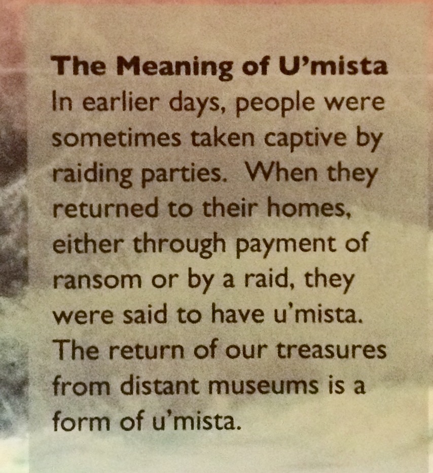
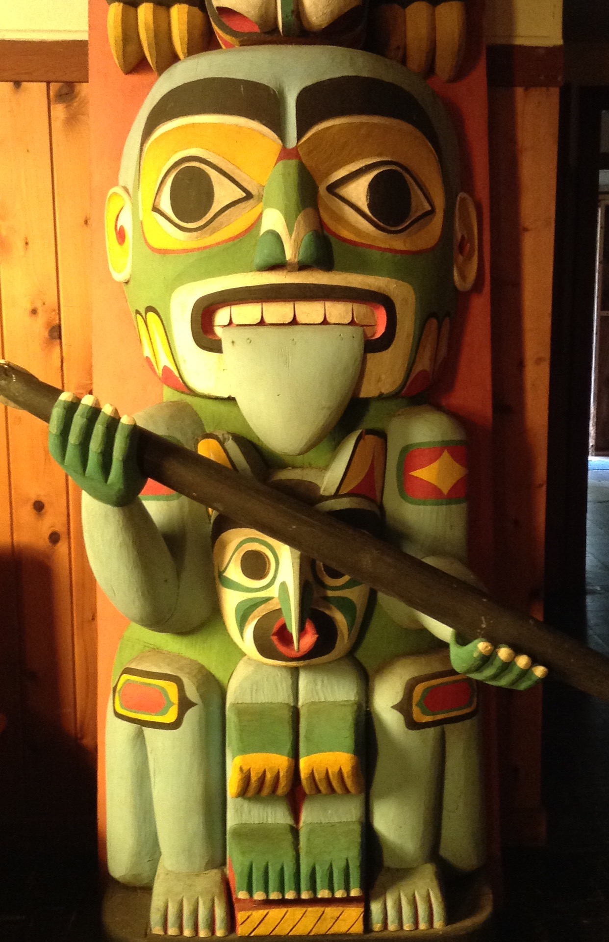
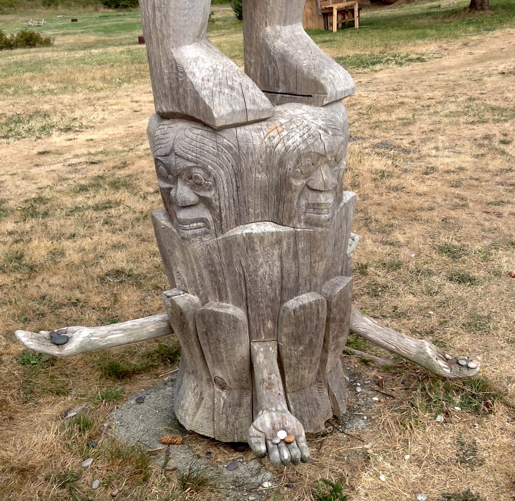
Caught the 8:40 am ferry, a short walk away, to Alert Bay, once home to a 1000-boat fishing fleet, today a quiet First Nations community. We came to visit U'mista, a longhouse replica housing a fantastic museum. A court case was won, mandating the return of Potlatch regalia, confiscated in the early 1900s when potlatches were ruled illegal in an effort to force assimilation. The masks, rattles, weavings and robes ended up in museums around the world, and in private collections. as they were returned, they were housed in two collections.
It's an amazing colection, beautifully displayed and annotated, and very meaningful to us after the progress of our education in Alaska and Haida Gwaii. No photos are permitted of the collection. The items are considered sacred. An arson in 2012 singed the building and damaged some masks, now being cleaned but not restored, as the fire is regarded as part of their history. At the museum a class was underway to teach women and girls how to weave cedar bark. On the way back to the ferry we met a man stripping bark from long strips, prepping the cedar for weaving. He asked if we'd visited the cemetary with its family crests on the graves. Dang, we had not known, and now the ferry was pulling in.
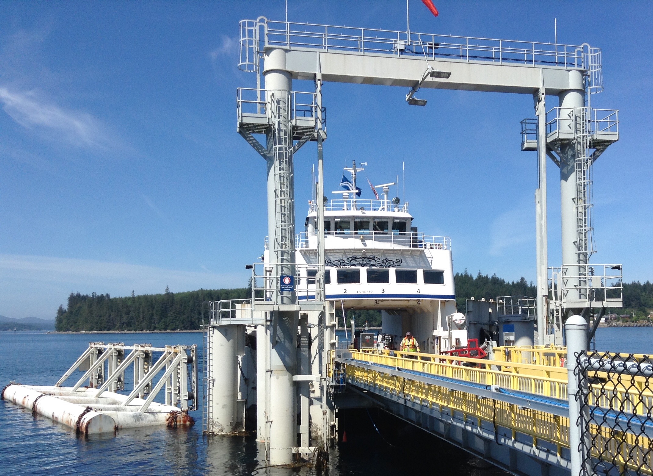
We catch the ferry from Port McNeill to Alert Bay.
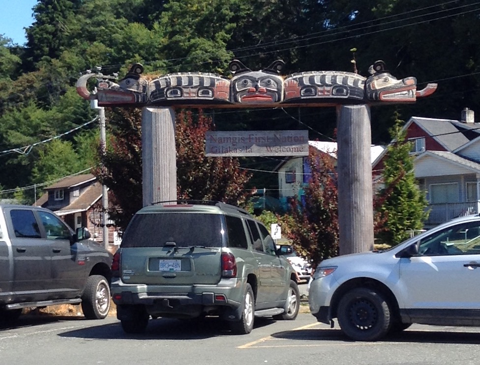
Wecome signage at Alert Bay, today a Native town.
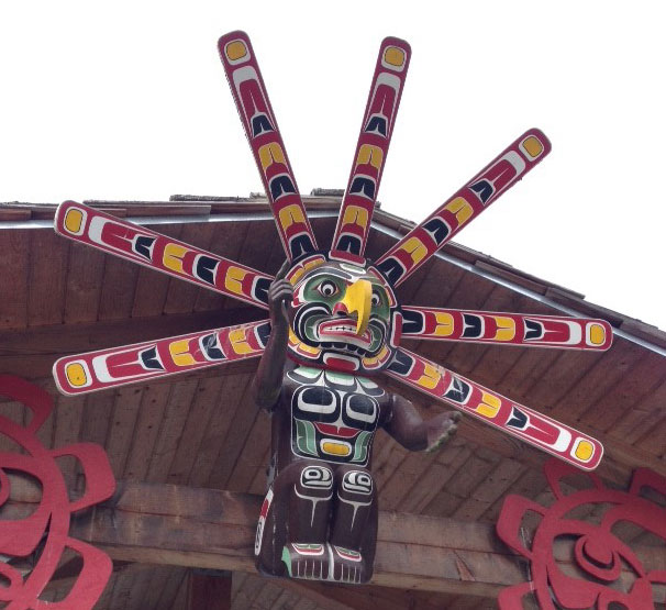
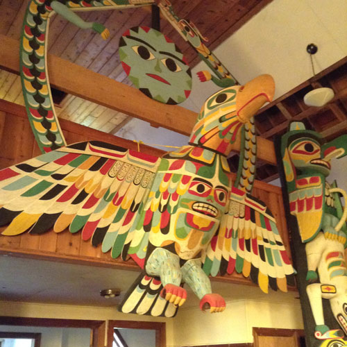
This bird-man-sun figure is one of five carvings on the way to U'mista.
From the ferry to the museum is a pleasant shoreline walk, partly boardwalk, with 5 rest shelters along the way.
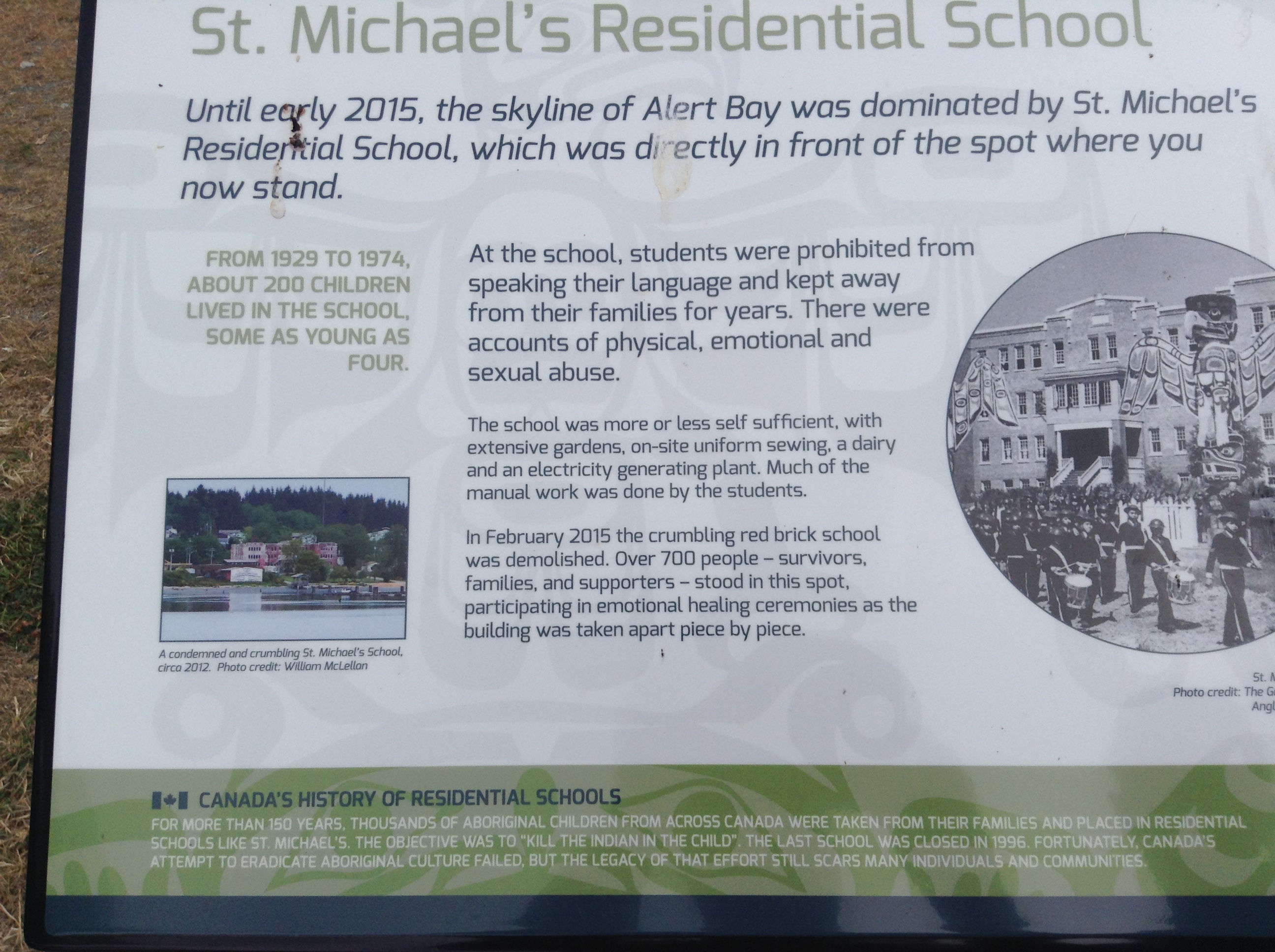
Alert Bay was home to a huge fishing fleet, and also to a large "residence" school. The purpose of the residence school was to eradicate the Haida culture through assimilation.
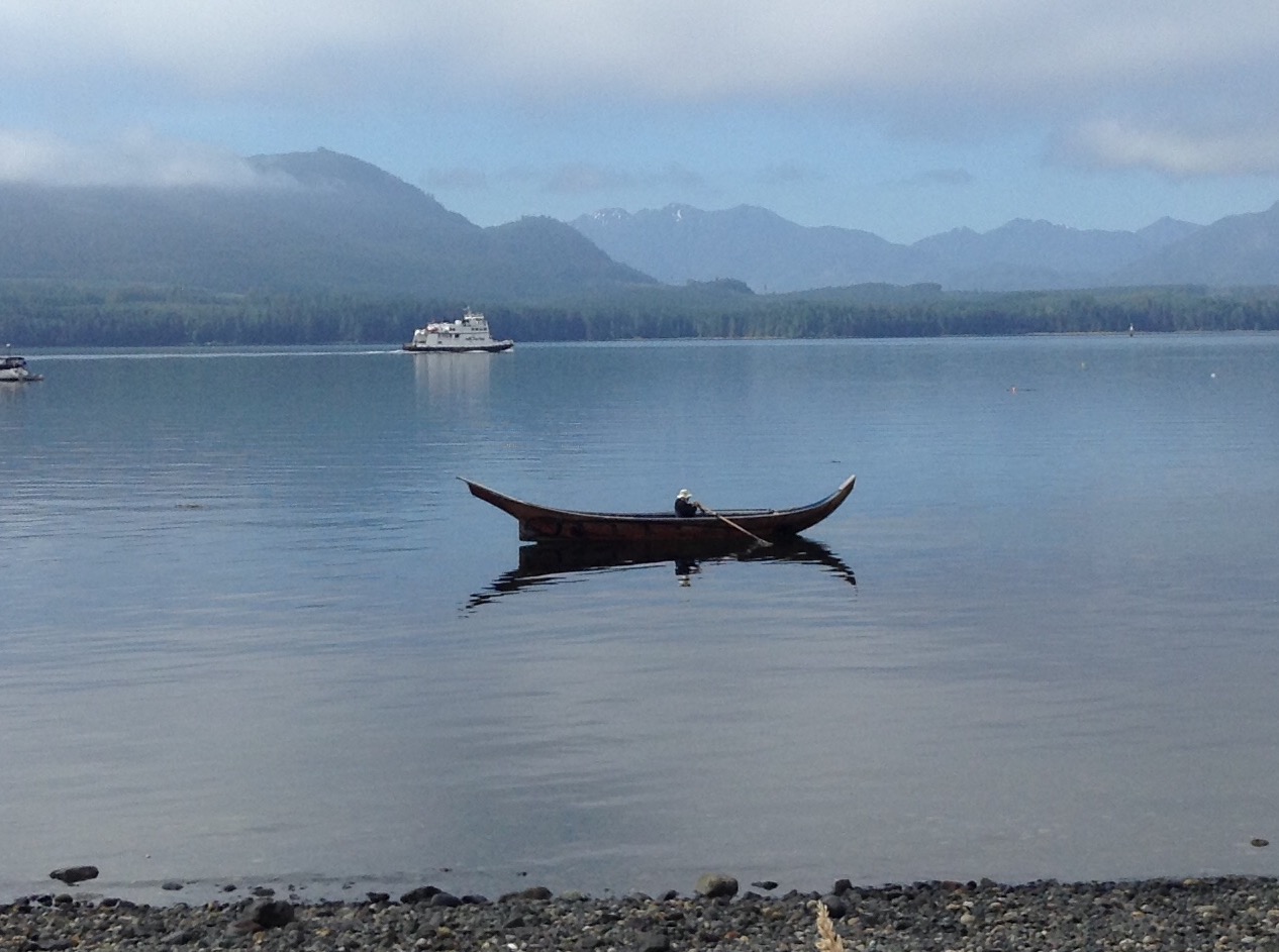
A rower crosses the bay, ferry in the background.
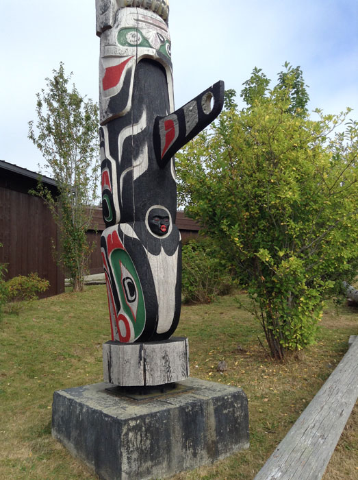
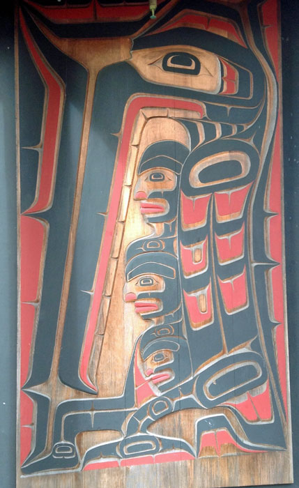
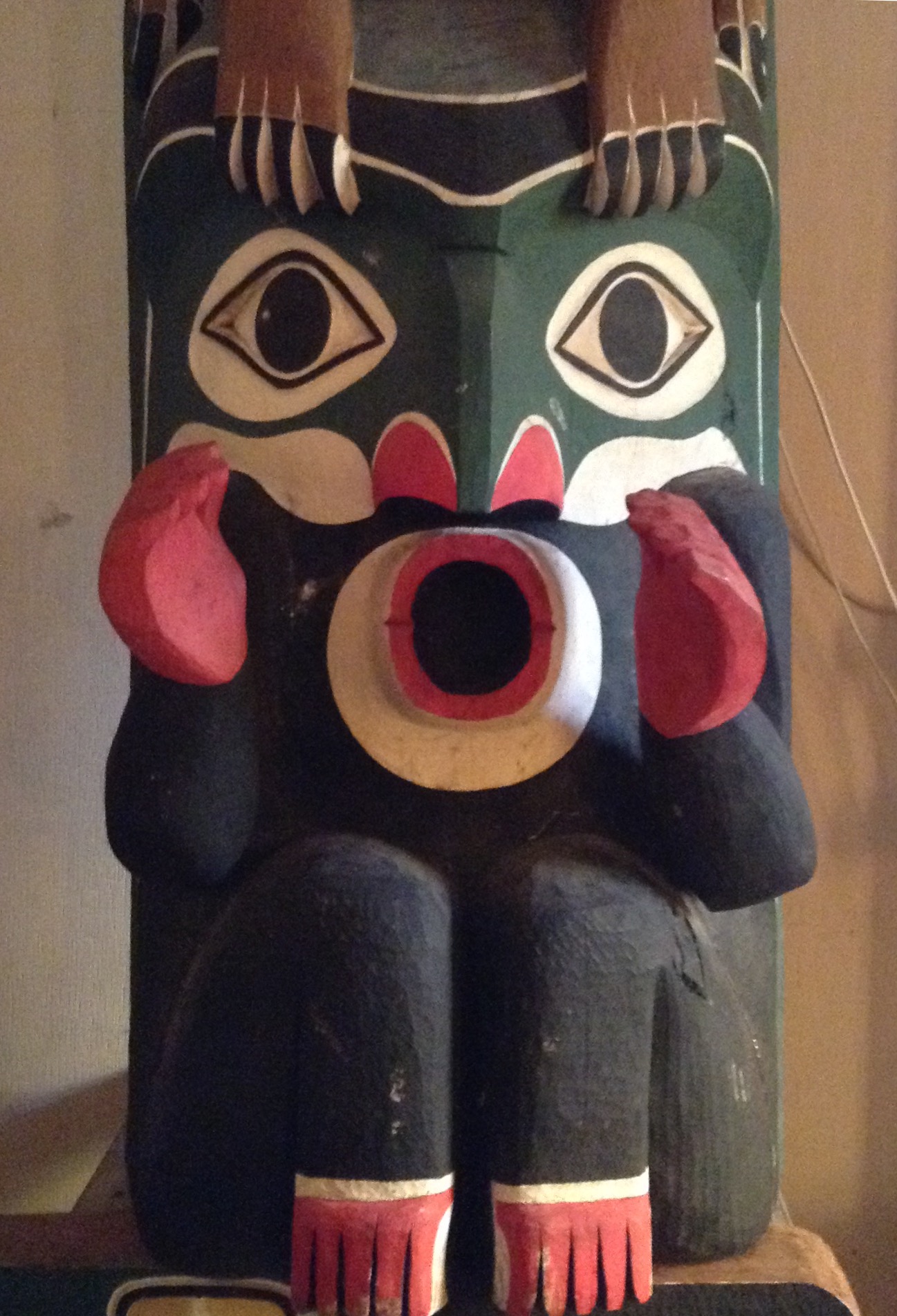
Another nice killer whale totem
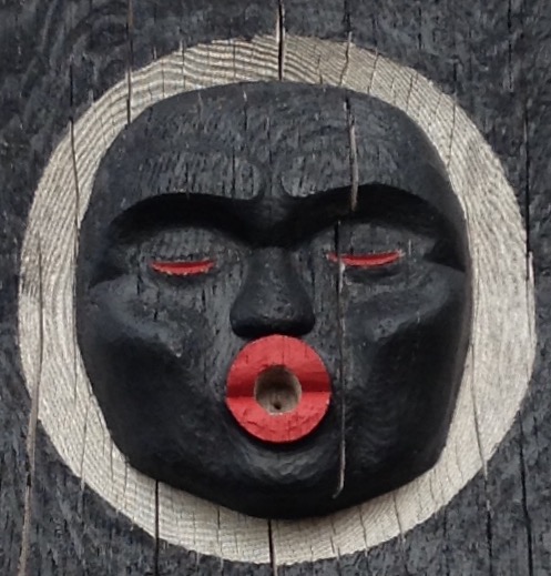
with the traditional face in the blowhole.
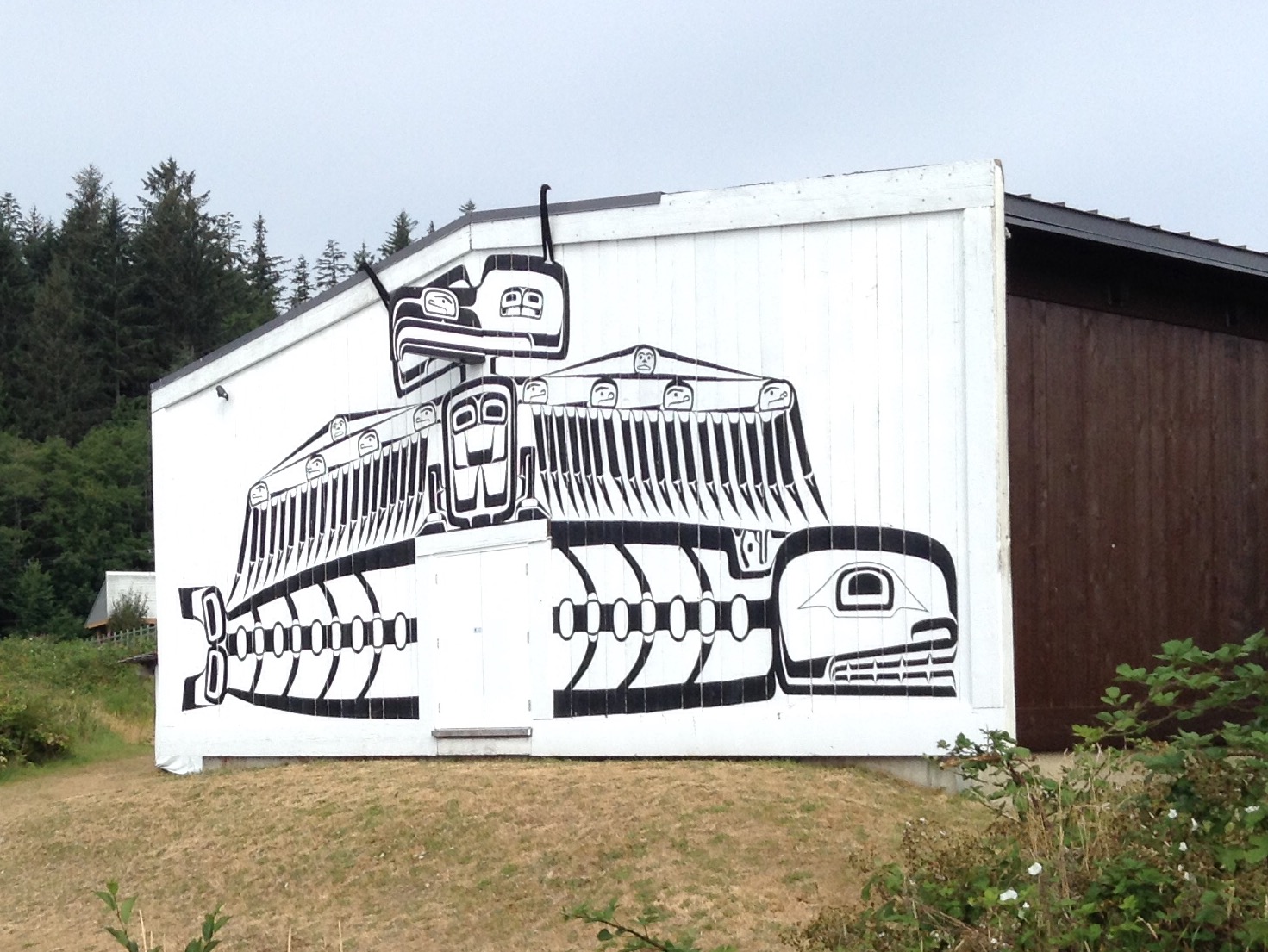
Today, Alert Bay is home to U'mista, a fascinating museum housed in this longhouse.
The museum houses an important collection of Potlatch regalia, stolen but now returned.
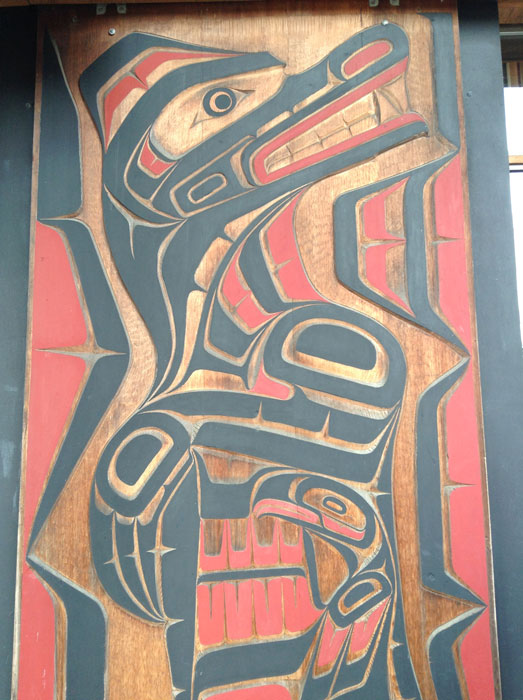
Traditonal carved house panels front the museum entrance.
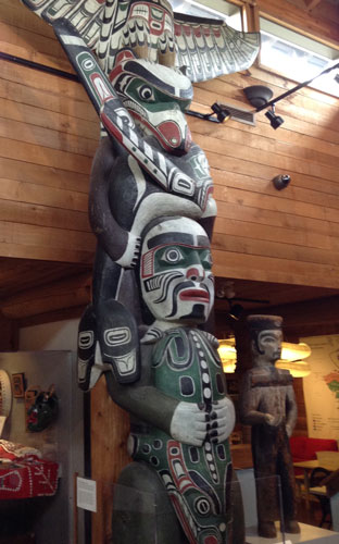
This totem is a rarity, only displayed indoors so paint is original.
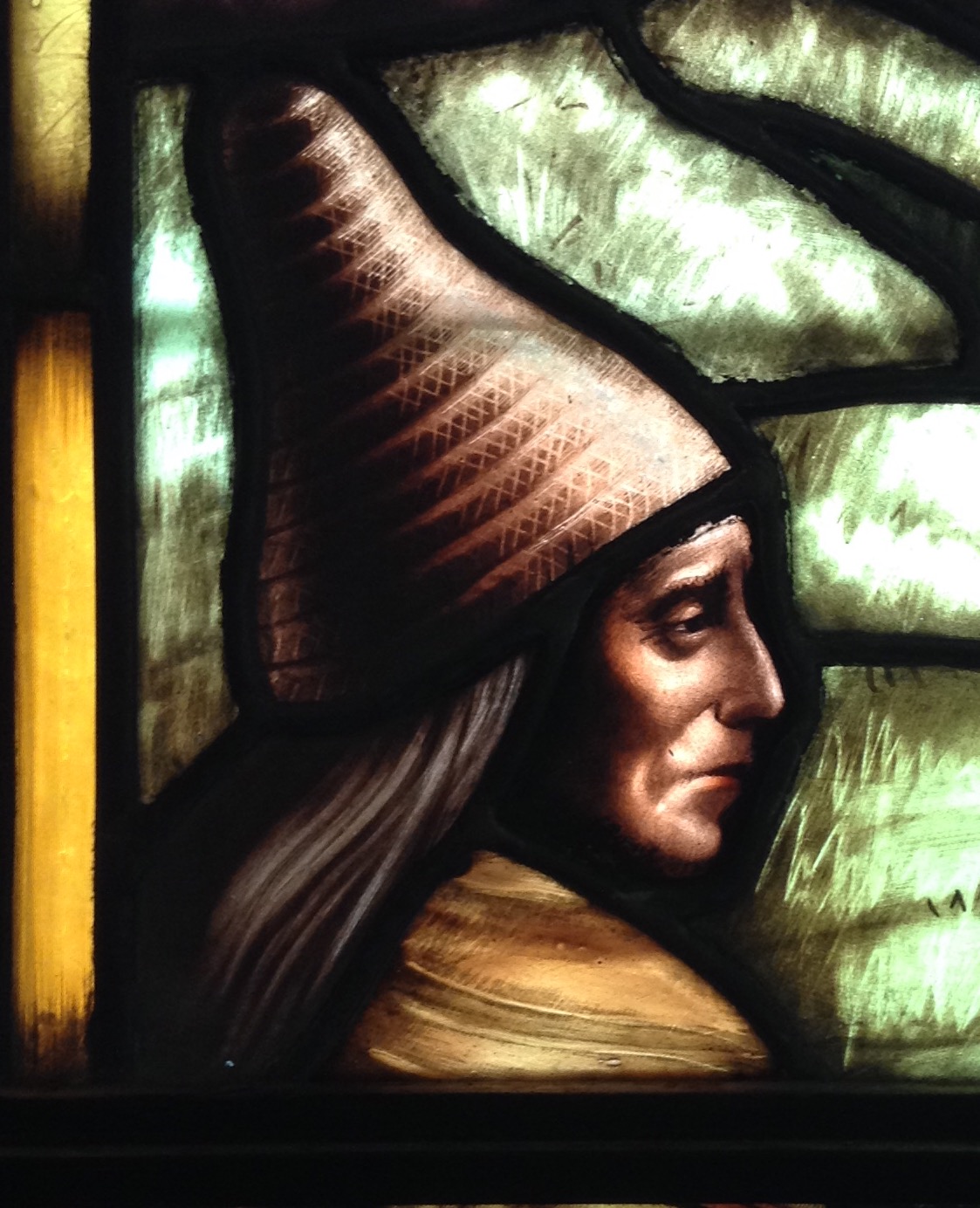
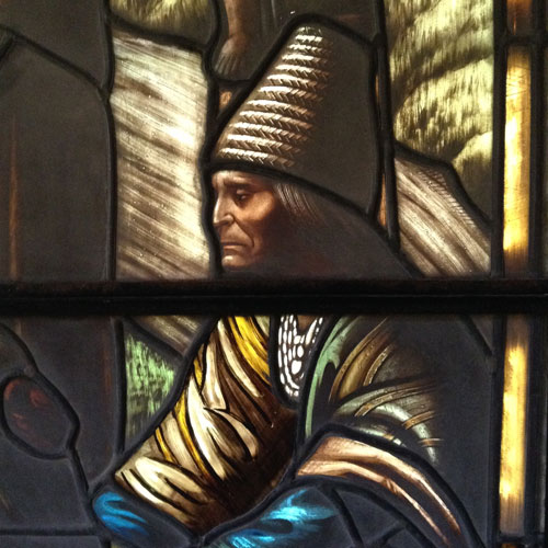
The potlatch regalia collection is considered sacred, so photographs are not permitted, though you can get a glimpse from the umista website. Especially fascinating were masks that opened, with a bird or animal face, transforming to a human face and back, reflecting the connections between man and the natural world. Dance aprons were decorated with puffin beaks to make noise. A beautiful film in the gallery connected the items to a present day potlatch held at the Alert Bay Big House, showing the regalia in use.
Potlatches were made illegal in Canada from 1885 to 1951, but still held until the 1920s when a new governor decided to enforce the ban, arresting and jailing leaders until they surrendered their regalia - potlatch masks, costumes and instruments. These items were sent to museums and private collections, and are still being recovered and restored. /p>
We landed with a ricochet crash at the Port McNeill dock (apparently normal) then were told at the ticket booth we should have just stayed on the ferry and were handed a pass to reboard fpr Sointula.
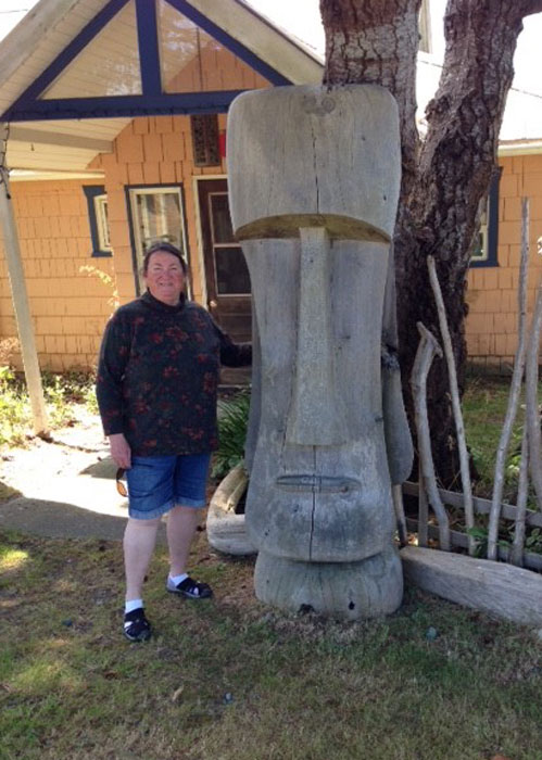
We seem to have landed at Easter Island.
Landing at Sointula, we walked north along the road past tidy houses with interesting driftwood fences. This community was settled by Finns when Finland was still part of Russia, and there is still a tiny remnant of its socialist past in the co-op store and museum exhibits. We found the Burger Barn at the marina and enjoyed fish and chips and good onion rings, then strolled back in time to catch the ferry home. Fun day.
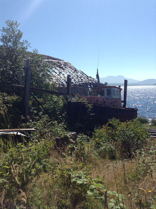
We like this decrepit boatshed.
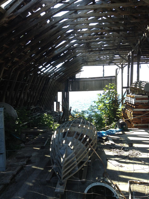
Inside is a ship on the ways and a couple partly-built skiffs.
August 4 - Port McNeill
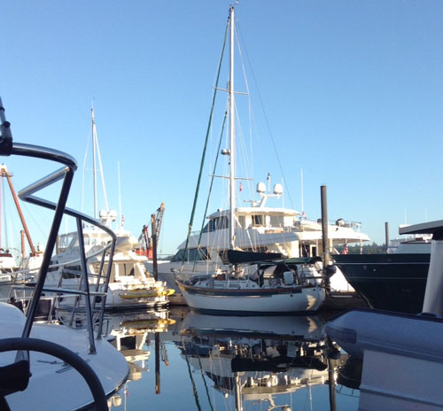
Baraka is tucked in among the big boys.
Yesterday we used North Island Marina's loaner van to run up to the Port Hardy airport in time for Dave's 6:40 am flight. He is off to Seattle for hos 50th high school reunion for a couple days. I am staying with the boat, getting caught up on small chores that never seem to get done when we are underway.
August 8 - Port McNeill
Dave had a great visit home, to attend his reunion, plus have a chance to see siblings, cousins, and son! He got back yesterday evening. Now we are planning the next leg.
We will leave tomorrow morning to head north to Bull Harbor on Hope Island, in preparation for jumping down the exposed outside of Vancouver Island. To get to Bull we must work up the Golitas Channel against northwest winds. Right now there are extreme tides, which mean strong currents. We want to ride the ebbs and sit out the floods, so our strategy tomorrow will be to leave here at first light, 6 am, ride the ebb to slack water, anchor at Port Hardy during the flood, and then leave at 4 pm to ride the second ebb to Bull Harbor. The ebbs will run as much as 3.4 knots at max, a big boost, but it will be a sloppy ride against the wind. We should arrive Bull Harbor well before 9 pm sunset. At least that's the plan...
The next day we will cross the Nawiti Bar and round Cape Scott to Sea Otter Cove, conditions permitting.
Our plans includes a return to some places we've visited before in Baraka on our shakedown cruise in 2003: Sea Otter Cove, Winter Harbor, Tofino, Ucluelet, Bamfield, plus a lot of remote anchorages, including the Bunsbys, and "Baraka Rock" where we scarfed off a chuck of fiberglass. Back in 2003 we had a handheld hiker's GPS and paper charts. Today we have very good chartplotting programs on computer and iPads, a huge improvement in accurate navigation. Though west coast charts do warn of uncharted rocks... We also have a sensitive radar, and expect some fog.
We may have sporadic cell coverage, but maybe no internet, and therefore no web updates, until late August.
August 10 - Bull Harbour
Dave checked the oil, and so far so good, so at 8 am we untied from North Island Marina and headed north. Our plan was to go to Port Hardy and anchor to await the afternoon ebb, using the time to check the engine one more time.
We tied up to the public dock and walked into town to have lunch at A&W (root beer float for my bday), get a few more groceries, and visit the tiny but worthwhile museum. By the time we were to leave, N wind and chop had us squashed against the dock. We used a stern spring line and were able to get the bow out enough to get away. This trick works great with a canoe-sterned boat, and we use it often.
We headed north against strong (not forecast) NW wind on the nose, which cancelled out the favorable current we'd expected. The nasty windchop was accompanied by fog. We kept an eye on the boat speed, wanting to make Bull Harbor on Hope Island during daylight, and looking at alternate anchorages if the wind kept building. It peaked at 32, then slowly laid down. We pulled into Bull and tied to the floating dock 5 minutes to sundown. We'd really wanted to make it to Bull Harbor, because the following day would be an exceptionally good one day window for making it around Cape Scott.
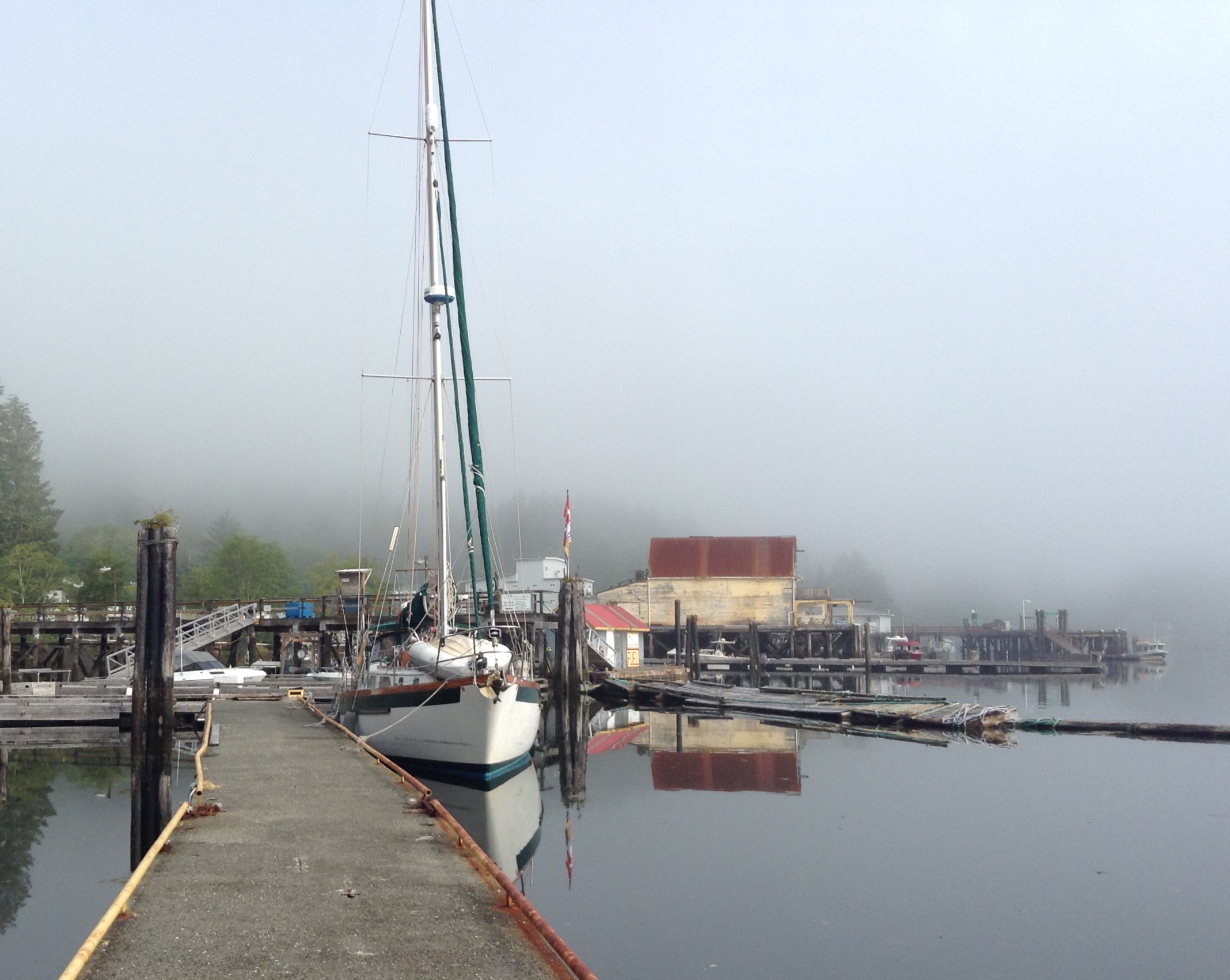
August 11 - Sea Otter Cove
The books recommend crossing the Nawitti Bar at high slack to enjoy an ebb current at the way to Cape Scott, the westernmost tip of Vancouver Island. That would have required getting away at 3am, unappealing after yesterday's challenges. So we slept in until nine, caught low water slack, and crossed to Tatnall Reefs to avoid the bar, and had a somewhat slow trip in flat water to the Cape. By then we were back in soupy fog, so we never did glimpse the Cape. There can be rough waters here, but in light wind our decks were dry. We rolled on down to Sea Otter Cove, which only emerged from the fog as we closed on shore.
It amazes us that we would have come into this cove with paper charts and a handheld hiker's garmin gps. You enter almost brushing toothy rocks, and turn past several drying shoals to reach the buoys. A sea otter watched us grab a buoy. We are the only boat here.
We plan to stay 2 nights. SE gale is forecast for tomorrow, so some swell may roll in. We tied 2 lines to the buoy. It is supposedly hurricane proof. It is a dozen tire floats ganged together in a triple stack with a skookum tie bar. When we were last here with Baraka it took plenty of rubbing to get the tire marks off the hull.
Dave just read his logbook from 2004. We stayed here then to sit out a gale, too. In taking the dinghy ashore to beachcomb, we had to drag it a long way up the lowtide muddy beach. The outboard was so heavy that we found a board we could drag that on, separate from the dinghy. We hiked to the outer beach, found a stinky dead whale and lots of fishing floats for the fence.
August 12 - Sea Otter Cove, Hunkered Down for a Gale
Quiet night tied to a "hurricane proof" buoy. There used to be 8 of them. Where did the other row of 4 go? We have to question...
The barometer dropped steadily and mid-morning the forecast gale showed up, 30-45 knots, gusting 50 inside the protected bay, more outside. A little chop rolls in and gusts make us sail a bit on the buoy. We are double tied and consider our Minorodo mooring, lines run to 6 cleats, but don't expect this blow to get much worse. Glad we planned to sit this trough out. Better weather is forecast the next couple days, so after this we will move along, if tomorrow morning forecast confirms.
Too gusty and now rainy to go ashore or check crabtraps. Every so often we a gust knocks us sideways and we bonk the buoy. We debate cutting loose and anchoring, but the buoy looks plenty stout so we stay put. At 8 pm the wind stops howling, halyards quiet, and seas lay down. Barometer rising.
August 13 - Winter Harbour
Crabtraps empty, bay calm, so we dropped our mooring lines and headed onward. We could hear the surf roar, and so were unsurprised to pop out of the Cove into big seas, leftover from yesterday's gale. We raised main and staysail to dampen the motion, but still had an uncomfortable run. I saw a lot of 3 meter seas, though none broke into the cockpit. Waves would form sharp peaks that broke like a hundred ladies waving hankies. We ran SE in light winds, then turned into Winter Harbor where we grabbed a place at the Outpost dock, did a load of laundry, had hot showers, and a real dinner. Nice to feel so settled after our rowdy couple days since McNeill.
Weather outlook good for a couple days. We may attempt to round Brooks Peninsula tomorrow is seas lay down. If still rowdy, we will only go as far as Klackish Basin.
Baraka at Winter Cove
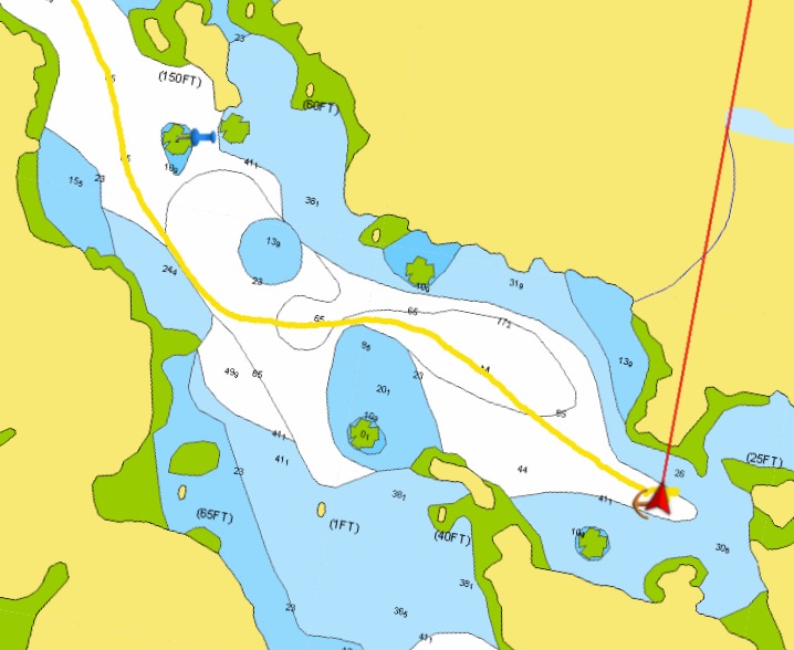
This time our track skirts "baraka rock" in the Bunsbys.
August 14 -Scow Cove, Bunsby Islands
On the way out of Winter Cove Dave spotted a mama black bear with three small cubs on the beach. Offshore seas weren't bad, still high with long intervals, so we skipped Klackish and headed out and around Brooks Peninsula. Like Cape Scott, it can offer severe headland conditions, so it was great to have a windless day. We passed inside Solander Island and saw huge colonies of sea lions.
We carefully followed our course. There are a number of offshore rocks and reefs. We tucked into the Bunsby Island group, turning past Baraka Rock, so named when we left a scarf of fiberglass on it 13 years ago. Our chartplotters show it clearly, but back then I stood on the bow looking for it, and finding it too late to avoid it.
Scow Bay is pretty, and the waters here are flat calm. Dinner in the cockpit.
August 15 - Walter's Cove
Quiet night in the Bunsby's. Saw one other boat, a sag wagon for a group of kayakers camping around the corner on the beach. The small skiff was laden with toys, standup boards, kayaks, canoes, and towing a jetski! So the kayak campers can rough it a bit but still have all the supplies and toys along.
We stayed inside toothy reefs in flat water all the way to Walter's Cove, a small landlocked summer settlement. Coming in, we zig and zag tight turns around buoy-marked shoals. Still can't quite figure out how we did all this 13 years ago without a chartplotter.
9 people live this side year-round (5 are a young family), plus a native settlement on the other shore. We tied to the public dock with a store, but it is only open afternnons 3 days a week, not today. We followed signs one km to Java the Hutt, where I enjoyed a falafel lunch and Dave had fish and chips. Too stuffed for pie, may have to return. They had internet so I looked at options to get home from Tofino for my Dad's birthday. There are scheduled flights, via Vancouver, so it should work out, but no cell coverage here to make calls. I'm hoping to just fly to Victoria and jump on the Clipper, but there are only flights Tofino-Victoria on certain days, and they cancel them if not enough seats are sold. So I must wait until Tofino to book.
Walter Cove is charming.
Secure in a nearly land-locked bay.
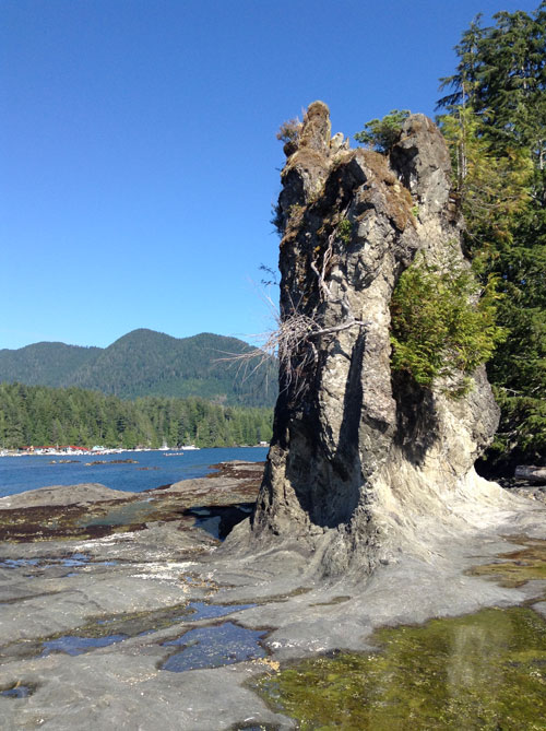
Rock formation on the beach at Walter Cove
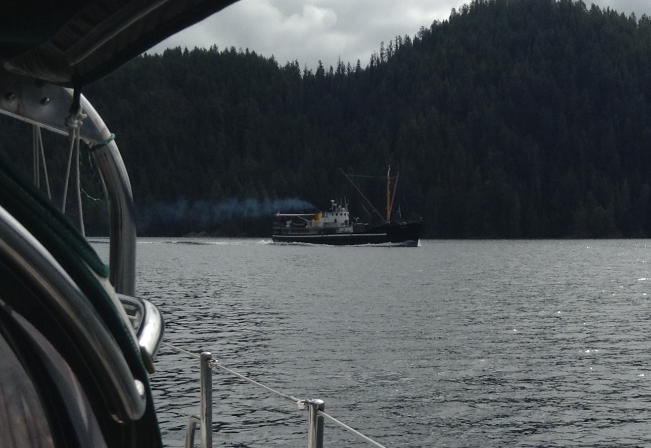
The Uchuck freighter glides by. The Uchuck supplies all the small West Coast communities.
August 16 - Nachalitz
Easy day run down to Nachalitz, a quiet anchorage tucked inside a bunch of small islets, once a first nations community. We entered through a narrow kelp-ridden passage, wrapping bullkelp on the prop a couple times, then rounded a couple buoys into the calm anchorage. We can hear the surf, but the boat is still.
We tossed the dinghy over to walk the beach at Village Island halfway across the spit until we were turned back by the rising tide, then followed a small boat back behind some islands through a labyrinth of skinny passages until it was too shallow to continue on. There are a handful of nice vacation homes here, with docks and skiffs for avid fishermen.
August 17 - Santa Gertrudis Cove
This morning we watched a black bear amble along the beach we walked yesterday. We headed inland, up the Tahsis Narrows rounding Nootka Island, then back south down long fjord-like channels. We'd planned to anchor in Friendly Cove but the afternoon breeze convinced us to tuck into Santa Gertrudis instead. Its entry has two rocks, both submerged, that you must thread. I stood on the bow and could barely see them against the late afternoon light.
We loaded the outboard on the dinghy and went around the corner into Friendly Bay, so named because the Nootkas gave Capt Cook lots of otter pelts. Margarite in the office took our $20 landing fee, and told us what we could see, including a small history lesson.
Lots to see here, welcome carved figure, Catholic Church with historic stained glass and a totem altar, fabulous history - Quadra handed Vancouver this territory in 1792 in the Nootka agreement, ignoring the native population who'd been here 4300 years, confirmed by archeology digs.
We visited Sanford Williams in his carving shed. He has made his living by traditional carving for 35 years and is a master of his art. He showed us a just completed paddle that displays the 4 winds, a beautiful bentwood box and 4 masks in progress. He does most work to order, selling through his website.
Sanford told us to walk a bit further to find a fallen totem, carved in 1919, that blew down during a storm some years ago. The blackberries are taking over, though the intricate totem still has some original paint. We hiked up to the lighthouse for spectacular views, then headed home to our quiet anchorage.
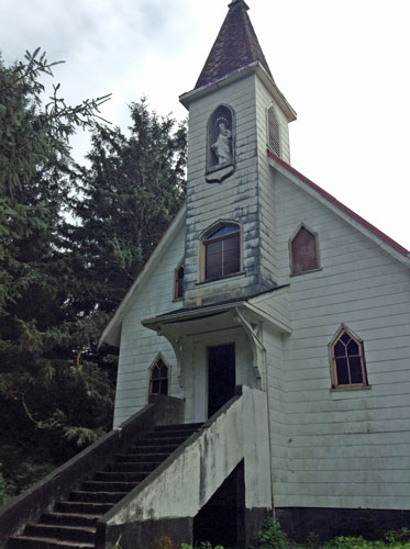
Catholic church at Friendly Cove
Traditional totems inside the church accomodate Haida spirituality.
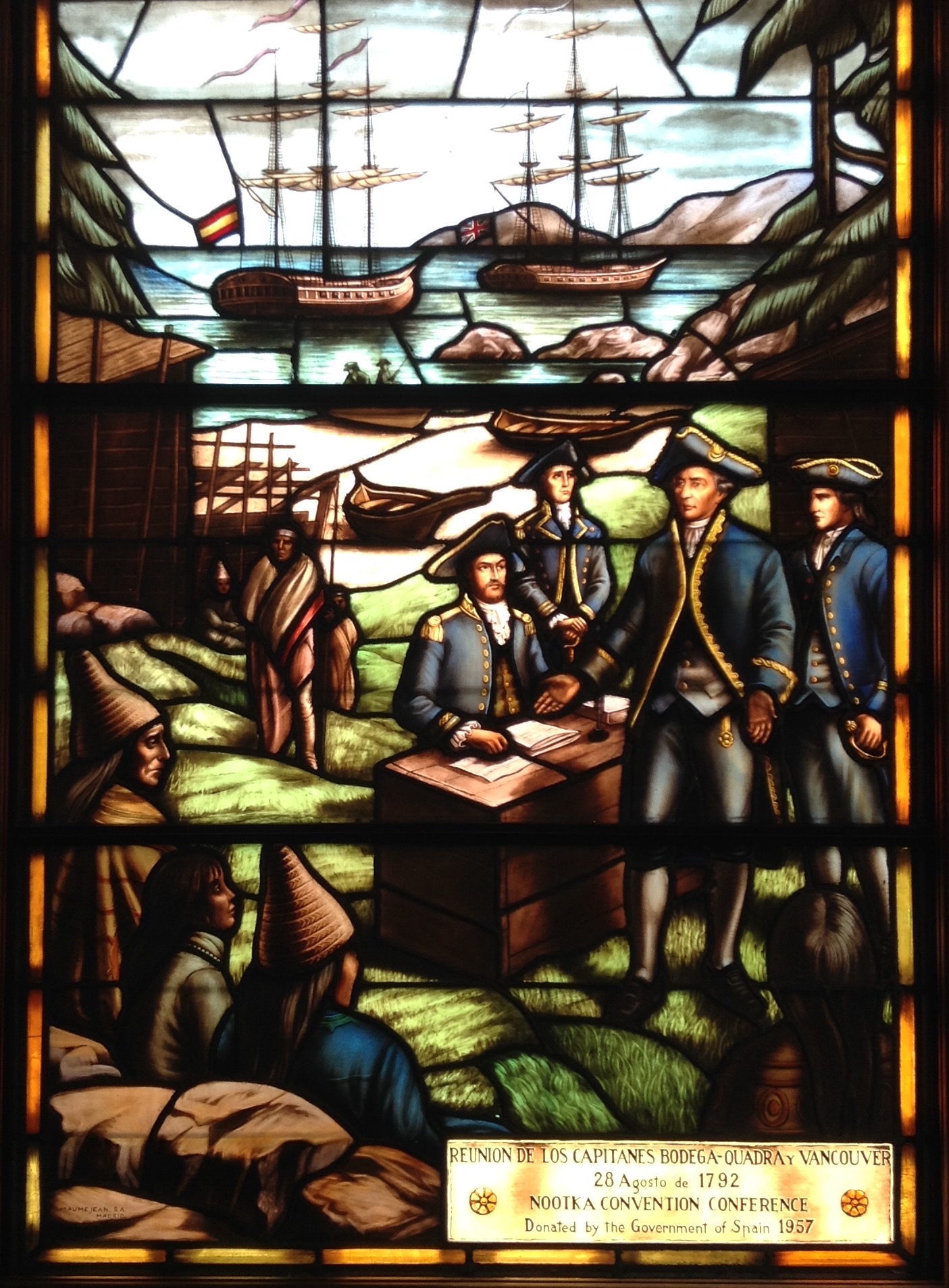
A beautiful stained glass panel, gift from Spain.
In 1792, Vancouver, representing England, accepted the region from Quadra, representing Spain, ignoring the tens of thousands of first nations peoples occupying the land.
The panels do capture the Nootka sentiment. To first nations peoples, land could no more be "owned" than water or air.
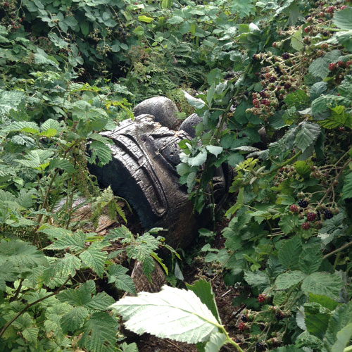
An old totem blown down is a storm
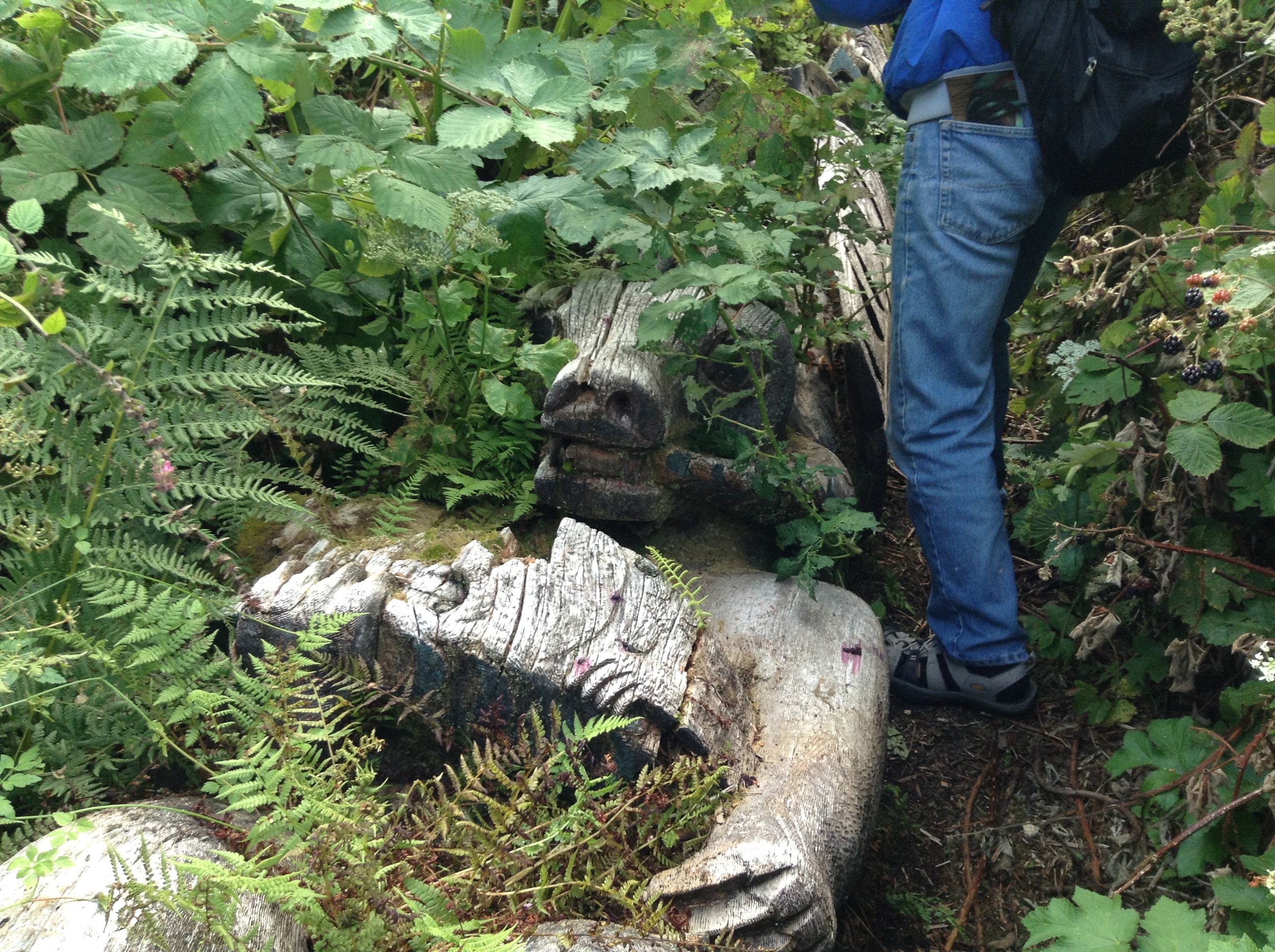
is being reclaimed by nature.
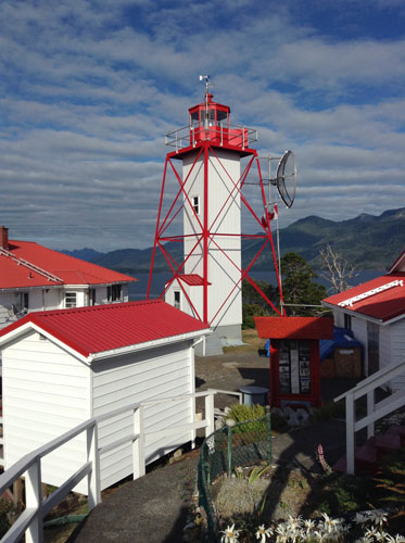
The lighthouse at Friendly Cove
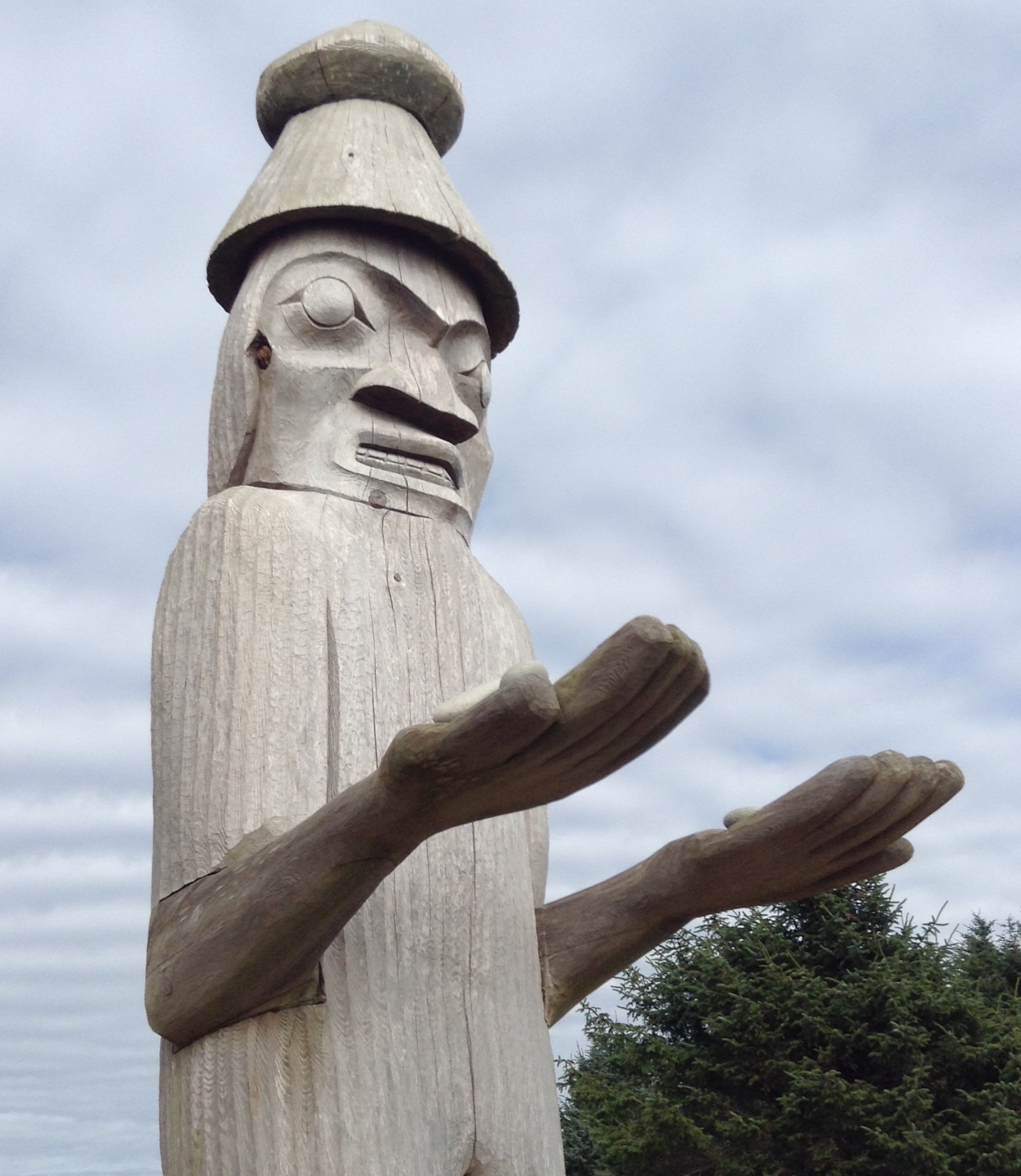
This figure carved by Sanford Williams
welcomes visitors to Friendly Cove.
August 18 - West White Pine
Forecast looked good for getting around Esteban Point, so we headed out in light winds motor sailing. We passed Estaban well offshore but could still hear the surf boom.
As we approached Hot Springs Cove we started seeing lots of high-speed boats ferrying tourists out from Tofino to enjoy the springs, enough so we were sure we likely wouldn't. We carried on, up pretty channels, then turned south again at Obstruction Island. In one twisty passage our course took us through a fish farm, or rather would have if we blindly followed it. There are an awful lot of these in BC, some charted, some not, and some now displace what used to be sheltered anchorages.
We worked into West White Pine, then crossed the shoal bar into a pond-like basin. Our charts and books claim the entrance is 3 feet at zero tide. Midtide, we saw least depth of 10 feet, though I could see bottom from the bow. Inside it is glassy calm and silent. Dave tossed the crabpots in and is tempted to jump in to clean the knotmeter, which hasn't worked for a month. We are a mere 3 hours from Tofino.
August 19 - Tofino
Yippee, one keeper crab in to pot. We waited a bit for the tide to roll in, then crossed the entrance shaol, no drama. Beautiful day. We motored down channels, being passed by a hornet's nest of buzzing high speed boats, taking tourists from Tofino to see bears, whales, and visit the hotsprings. We arrived just after slack water and tried to grab a berth at the 4th street docks but they are doind some kind of construction, so no transients. We carried on just a bit further and scored a slip at the Weigh West Marina for 4 nights. They we must leave and anchor out. We settled in, I was able to book my trip home (bus to Victoria, then clipper to Seattle). Then we walked to the bustling down, packed with tourists speaking a lot of European languages. Tofino offers hiking, surfing, bears and whales, a couple excellent native art galleries, and lots of restaurants. More people than we've seen in months. We bought a baguette and headed home to the cockpit for out crab dinner.
August 24 - Ucluelet
Baraka was moored for 4 days at the pricey $2.35-a-foot marina in Tofino. We enjoyed the town, and some hikes to the beaches, but the horrific current was scary. We were the end tie on a dock, next to the channel. As the tidal current ripped by, dozens of boats were swept sideways with little manuverability. Nobody rammed into us, but we felt vulnerable.
The marina couldn't extend our moorage. The main public dock is closed for dredging, and there were no other moorage options. A sailboat drug a bit in the anchorage when currents reset the anchor. The wharfinger suggested we move to Ucluelet, 25 miles further south, where more and better moorage is available. Friends on Silverado came by and reported Ucluelet moorage is good and the town is nice.
So yesterday at the brief slack water we untied and headed out into NW wind, chilly thin fog and following seas. We arrived early afternoon and tied to an outer dock, then moved inside the protected basin today, where we can get electricity. A good place to park Baraka while I head home for a family event, and Dave will stay with the boat.
We were last here in Moulin Rouge, maybe 1986, on a Barkley Sound trip.
September 2 - Ucluelet
Jan is back aboard after a fun trip home, including a 6-hour bus ride to Victoria, then Clipper to Seattle, then the same in reverse. I got to attend my amazing Dad's 97th birthday at Haller Lake, with all 5 of my siblings, plus several other family get-togethers.Good times!
Back at Baraka Dave worked on a number of mostly costmetic projects, though today he is tackling a leaking hatch. We plan to linger here at Ucluelet a few more days if the weather holds. I want to strip the side and caprail.
September 7 - Bamfield
After two weeks, we finally pried ourselves away from the well-run Ucluelet Marina, and headed across Barkley Sound. The past week we had perfect weather, allowing Dave to rebed 2 leaky hatches and Jan to strip and varnish the starboard caprail. Our last day there we hiked out to Ampritrite Lighthouse on a beautifully groomed gravel trail. Signs warned that wolves were "very active" so I carried an airhorn in my hand, but all we saw were tourists enjoying the walk. The loop trail had dozens of cliffside viewpoints and trails to pocket beaches. To cap off the day, we went to Abbondigo for excellent wood-fired pizza.
This morning we motored out into fog, and threaded the Broken Group islands, then turned into Bamfield inlet and dropped the anchor. Tomorrow we will toss the dinghy in and explore. We were last here more than 30 years ago, in Moulin Rouge. Back then we could barely lift our teeming crabpot.
Bamfield is a boardwalk town. One side of the channel is accessible by a seasonal logging road. The other side, only by boat. Townspeople get around in their skiffs.
September 10 - Port San Juan
Last time we were in Bamfield, Joel was 6 years old. We counted an eagle in every tree, and could barely lift the teeming crabpot. This time, the cute boardwalk town still holds its charm. The local industry is sport fishing, and a fleet of trailerable-sized boats heads out of the inlet each morning. We walked a gravel road to Brady's Beach, and explored some backroads, then hunkered down for a rainy Saturday. This morning we weighed anchor, spending an extra ten minutes extricating the hook from a huge heavy ball of newspaper kelp, then headed around the corner to run down Vancouver Island to Port San Juan. This is a huge rectangular bay, wide open to the SW, but we tucked into a small byte and are mostly out of the gentle swell. Ashore is the southern terminus of the West Coast Trail, which winds along the coast from here to Bamflield. There are hikers camped ashore in a dozen tents awaiting a ride back to Port Renfrew to complete their hike.
September 11 - Sooke
Flatwater day, we motored eastward in Juan de Fuca, heavily harvested forests to the north of us, and the shadowy purple Olympics to the south across the Strait. We turned into Sooke Harbour and anchored in the armpit of Whiffle Spit, only to be warned by a local that our anchorage has rocks that could scape our keel at low tide, so we moved back out a bit to deeper water, still within the embrace of Whiffle. Dave put the crabpots in. Tomorrow we will explore the basin. Sooke is twenty-some miles from Victoria. We have been here before, having biked out the Galloping Goose rail trail. But it has been many years.
September 12 - Sooke
Today marks our 47th anniversary. Dave gave me chocolate and a fitting card mentioning our life of adventure. I can't imagine having a better partner and friend.
We dinghied into town and gave my fitbit a workout, then started in the dinghy for the inner lagoon when the outboard prop started slipping, a latent souvenier from jamming the prop in Bamfield inlet in a floating block of wood. It had behaved ok since then, but today would only propel us slowly. We limped home, and Dave swapped in an old spare prop. We checked the crabtraps and found 2 keepers, then dinghied ashore to walk the length of pretty Whiffin Spit. A trail winds to the light tower at the end, then we walked back on the shore, with its big smooth boulders. This evening, enjoying our crab, the winds piped up as forecast. Dave had rigged the riding sail, something we had not used for years. It keeps us pointed directly into the gusting wind, rather than sailing on our anchor. Works great.
September 16 - Victoria
We have already been here 2 days, tied to the Causeway Docks just in front of the Empress. Just ashore many hundreds of tourists stroll, having arrived by Clipper, Coho, and Cruise Ship. Seaplanes stack up in the bay waiting for takeoff, and buglike ferres buzz around the bay. Buskers line the shore, some good, others like the bagpiper who seems to only know a single tune. After a summer of anchorages to ourselves, the contrast couldn't be greater.
I am finishing the caprail revarnishing, and Dave solved a propane problem with our second tank, and rewired the windlass switch which is finicky again, second time this summer. He will order a replacement switch when we get home. Yesterday I spent a couple hours in the excellent provincial museum. They had special exhibits on family, and cancer-marathoner Terry Fox, plus their beautifully mounted First Nations exhibits, especially meaningful after our summer up north and in Haida Gwaii. Last night Dave and I attended the Wonder Woman movie in 3D IMAX, fun! We will park here another couple nights, then head to the San Juans for a few days. Each evening we enjoy dinner in the cockpit as the Parliament Building lights come on, and the Empress lights up. Magnificent setting. Wonderful to have moorage in this specacular place.